City-Directedness Chart
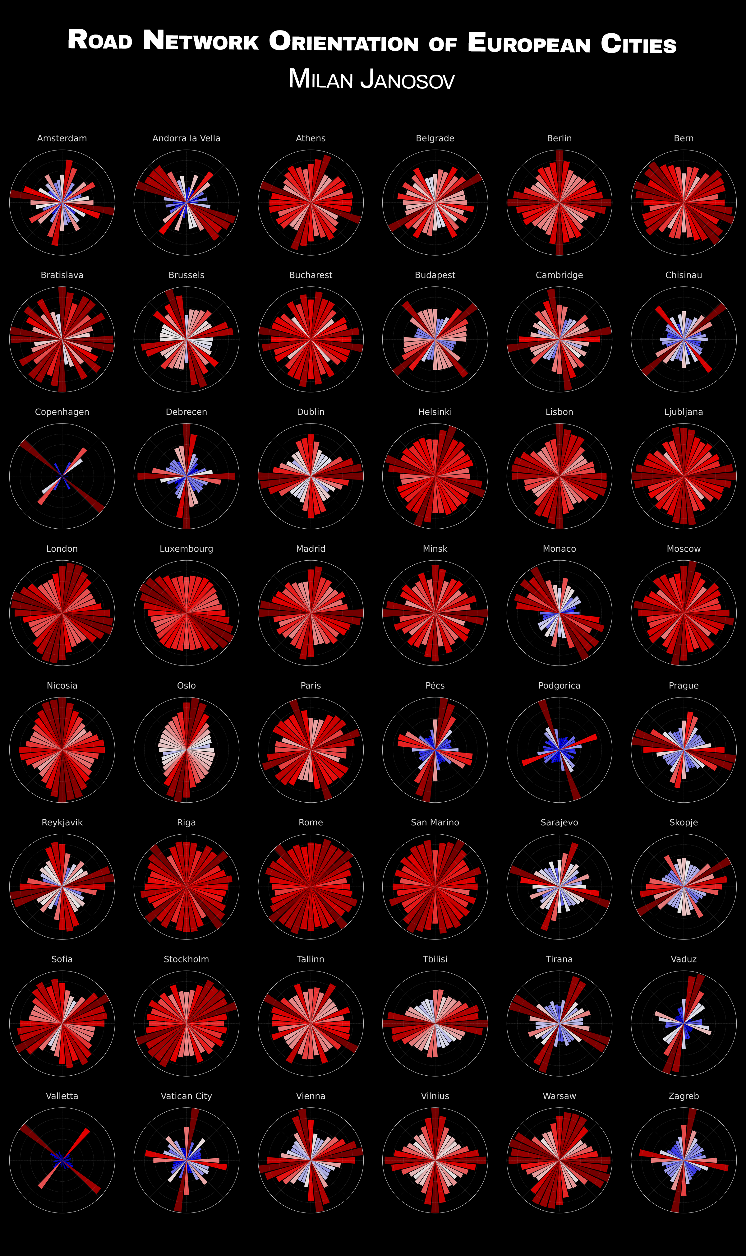
This graph shows the directedness of each city based on its road network acquired from OpenStreetMap using OSMNx.
For this map /?/ chart, I recreated one of my all-time favourite visualisations, originally by Geoff Boeing. This graph shows the directedness of each city based on its road network acquired from OpenStreetMap using OSMNx. Namely, each radar plot shows the total length of road segments (measured in e.g. kilometres) pointing in certain directions marked by the bars. As an example, I picked 48 large European cities. Have you visited any of them?
𝐈𝐧𝐬𝐩𝐢𝐫𝐚𝐭𝐢𝐨𝐧: https://geoffboeing.com/2019/09/urban-street-network-orientation/
Data accessed: 2023 November 24