Elevation Map of Budapest
Using Budapest Open Data to visualize the elevation lines of Budapest from the plain of Pest on the hills of Buda.
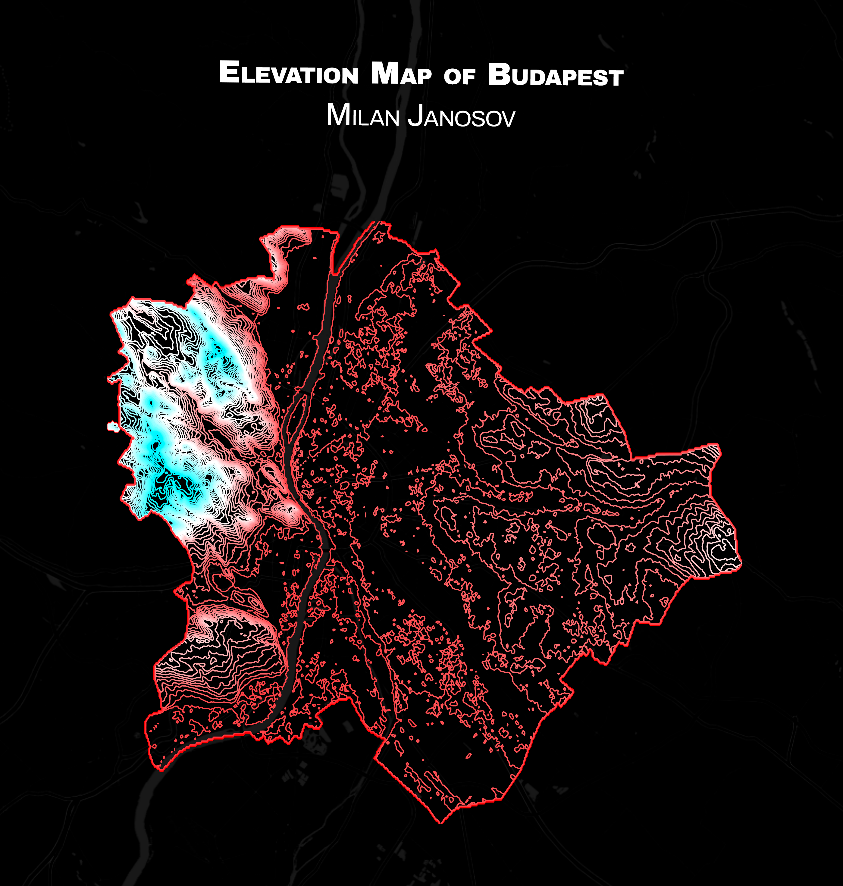
So now we are going minimal - and my minimalistic map is my all-time favourite, Budapest, especially its elevation contour lines collected from the Budapest Open Data Portal. The map clearly shows how the Danube split the city in half, how plain the Pest side is on the right (at around 100m above sea level), and how the Buda hills look down on it from a whopping height of 500m!
𝐃𝐚𝐭𝐚 𝐬𝐨𝐮𝐫𝐜𝐞: https://atlo.team/boda/
Data accessed: 2023 November 12