Road Network of Budapest
Visualizing the road network of Budapest using OpenStreetMap and the OSMNx package.
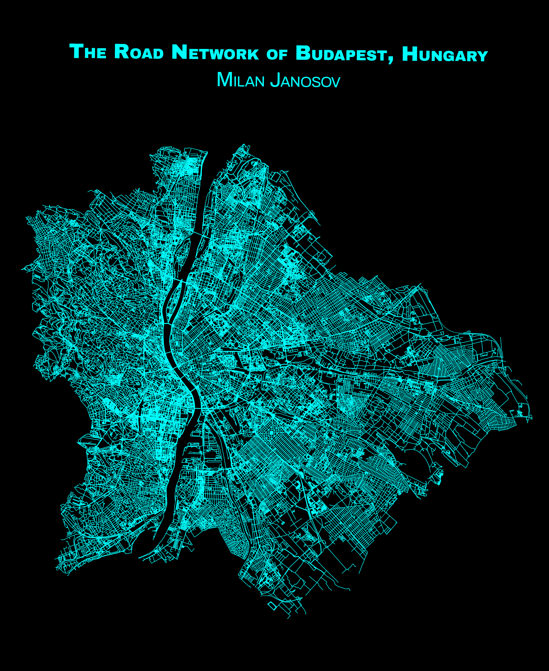
Today, not for the first time, I show you the road network of my hometown, Budapest, Hungary, using OpenStreetMap data via the OSMNx package.
Fun fact: this road network representation of Budapest has 115,539 nodes and 316,096 edges, while the length of all road segments measures 1,879 km!
𝐂𝐨𝐝𝐞 𝐚𝐧𝐝 𝐨𝐭𝐡𝐞𝐫 𝐭𝐮𝐭𝐨𝐫𝐢𝐚𝐥𝐬: https://www.patreon.com/milanjanosov
𝐎𝐒𝐌𝐍𝐱 𝐬𝐨𝐮𝐫𝐜𝐞: https://osmnx.readthedocs.io
Data accessed: 2023 November 1
#gis #datascience #maps #geospatialdata #datavisualization #spatialanalytics #spatialdata#geospatial #data #ai